Upper Missouri River Breaks Nat'l Monument

The Upper Missouri River Breaks National Monument became a part of the National Landscape and Conservation System in January 2001. This monument consists of 375,000 acres of public land in central Montana and straddles the Missouri River from Fort Benton to the Robinson Bridge on US Highway 191. It will be managed for current and future users and for visitors from all over the world. The area is considered a destination attraction for Montana’s tourism and travel program.
This monument is managed by the Bureau of Land Management and most of the monument staff works in the BLM’s Lewistown Field Office in the heart of central Montana. Brochures and maps, as well as a website, are available for folks desiring more detailed information about this visitor attraction.
Visitors can experience a myriad of outdoor adventures when they come to this portion of the “Big Sky” state. For those planning a trip that includes a water adventure, we have the Upper Missouri National Wild & Scenic River (149 miles that can be broken into segments that might include a day-use trip, 2 ½ day trips, or a 7 day trip).
For the history buffs and those looking for educational opportunities, there are the Lewis & Clark and the Nez Perce National Historic Trails plus the Cow Island and D-Y (Dominion of Canada to Yellowstone River) Montana Historic Trails. A Kid Curry overlook, which is associated with the famous Hole-in-the-Wall Gang (Butch Cassidy & Sundance Kid), is accessible by vehicle on the north side of the Missouri River along the Bull Creek Road.
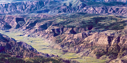
Photographers marvel at the brilliant colors of the scenic geology and topography that time and nature have etched in this national monument. The Karl Bodmer cultural landscape painting sites are found along the Missouri River.
Those interested in wildlife viewing opportunities won’t be disappointed. The entire wild & scenic river corridor is designated as a Watchable Wildlife area. The monument borders the west end of the Charles M. Russell National Wildlife Refuge northeast of Lewistown.
The Missouri Breaks National Backcountry Byway, east of Winifred, provides opportunities for those visitors seeking a scenic drive. This route travels through private ranch land and public land. Various vantage points along this route provide views of the Missouri River, the overall geographical landscape, the historic trails, several wilderness study areas, and a vast landscape.
None of this route is paved; portions are graveled; and its use is very weather dependent (if it’s rainy, don’t try this drive). The historic Stafford/McClelland river ferry is a must-see attraction and is accessible from this byway.
For more information, contact the BLM office in Lewistown at 406-538-1900 or the river management station in Fort Benton at 406-622-4000 or 877-256-3252 (toll free).


Upper Missouri River Breaks Nat'l Monument